
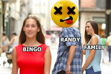
Xochitl, Pfc. Sandoval, Ashley Wells, Crystal Quintero (eds.), Wisdom Quarterly OPINION

Mapping "mistake"? Was California an island?
 |
| California is named after Black Queen Califia (Las sergas de Esplandián) |
 |
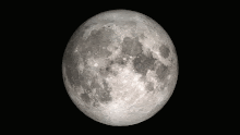
| Sure looks like an island even today (WQ). |
ABOUT: Johnny Harris is a filmmaker and journalist currently is based in Washington, DC, reporting on interesting trends and stories domestically and worldwide. He holds a BA in international relations from Brigham Young University and an MA in international peace and conflict resolution from American University.
California is an island, upper and lower, Alta and Baja, with the Sea of Cortes/z (Gulf of California or Vermillion Sea) behind it, extending up into the Salton Sea or the remnant that remains of it (Wisdom Quarterly).
 |
| Our peninsula sure looks like a former island. |
That's how it got the great abundance and diversity it now enjoys. For instance, the State of California has more plant and animal species than all of the other states in the U.S. combined, by far. There's no comparison. We have the world's tallest tree (hidden up north so people will stop climbing it and trampling the woods around it).

 |
| Map shows Gulf of California, Mexico, extending up all the way to wrap around the island. |
.
 |
| Who controls low orbit satellites? |
The Salton Sea can hardly be explained as an accident that just happened to linger this long. It's enormous! It's far easier to imagine it's the remnant sea that once wrapped around the Island when water levels were higher. There's a lot of earthquake activity around here that could have changed things, pushed up the plate we're on.
A wide waterway, like the American River in the state capitol, Sacramento, might have been considered part of the Pacific Ocean. More likely, the shape of the state was not as it is today.
In the view of Mexico, particularly under the Spanish Empire, Alta California ("Upper California") extended far beyond its present borders. And there was no need to survey it as it was home to indigenous people, just as Mexico was. But European Spain sure thought it should be mapped, missioned (the first "concentration camps"), and enslaved, with the local population put to work in the service of the Church and Empire.


No comments:
Post a Comment