

Sineru is said to be surrounded by seven mountain ranges:
(SNA.ii.443; Sp.i.119; Vsm.206; cp. Mtu.ii.300; Dvy.217). Its breadth is eighty-thousand leagues, A.iv.100).
At the peak of Sineru is Tāvatimsa, the "Heaven of the Thirty-three" (SNA.ii.485f). At its foot is the Asurabhavana , the Place Where Asuras Live, which is 10,000 leagues. (The Asurabhavana was not originally there, but sprang up by the power of the Asuras when they were cast out of Tāvatimsa by the "King of Kings," Sakka (DhA.i.272; see, e.g., SNA.i.201).
In the middle are the four "continents" (Mahādīpā, literally "great islands") with their two thousand smaller land masses (dīpā).
Sineru is often used in similes, its chief characteristic being its unshakeability (sutthuthapita) (e.g., SN. vs.683). It is also called Meru or Sumeru (e.g., Cv.xlii.2), Hemameru (e.g., Cv.xxxii.79), Mahāneru (M.i.338), and Neru (J.iii.247).
Each "World System" (Cakkavāla) has its own Sineru (A.i.227; v.59), and a time comes when even Sineru is destroyed (S.iii.149).
When the Buddha visited Tāvatimsa, he is said to have covered the distance between the earth and his destination in three supernormal strides. He set his right foot on top of the Yugandhara mountain range, his left on Sineru, and the next step brought him to Tāvatimsa (suggesting that Tavatimsa extends high beyond Sineru). The whole distance covered is said to have been sixty-eight hundred thousand leagues (DhA.iii.216).

Mt. Sumeru
Payer.de
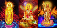
NAME Sumeru (Sanskrit) or Sineru (Pāli) is the name of the central world-mountain in Buddhist cosmology. Etymologically, the proper name of the mountain is Meru (Pāli, Neru), to which is added the approbatory prefix su- resulting in the meaning "excellent Meru" or "wonderful Meru." The concept of Sumeru is closely related to the Hindu mythological concept of a central world mountain, called Meru, but differs from the Hindu concept in several particulars.
SIZE According to Vasubandhu's Abhidharma-kośabhāṣyam, Sumeru is 80,000 yojanas tall. The exact measure of the yojana is uncertain, but some accounts put it at about 24,000 feet, or approximately 4 1/2 miles. It also descends beneath the surface of the surrounding waters to a depth of 80,000 yojanas, being founded upon the basal layer of Earth. Sumeru is often used as a simile for both size and stability in Buddhist texts.
Sumeru is said to be shaped like an hourglass, with a top and base of 80,000 yojanas square, but narrowing in the middle (i.e., at a height of 40,000 yojanas) to 20,000 yojanas square. (Interestingly, this would make it the symbol of Jainism, which conceives of the universe as having a definite shape -- an hourglass like tower).
Sumeru is the polar center of a mandala-like complex of seas and mountains. (In fact, the great Angkor Wat was laid out, as many temple bases are, in a pattern reflecting this conception of the universe and the known worlds and levels, with central pagodas emulating Sumeru and the lower heavenly worlds corresponding to it). The square base of Sumeru is surrounded by a square moat-like ocean, which is in turn surrounded by a ring (or rather square) wall of mountains, which is in turn surrounded by a sea, each diminishing in width and height from the one closer to Sumeru.
There are seven seas and seven surrounding mountain-ranges, until one comes to the vast outer sea which forms most of the surface of the world, in which by comparison the known continents are merely small island-like land masses. The known world, which is located on the continent of Jambudvīpa (the Indian subcontinent flanked by the great mountain wall that is the Himalayan range), is directly south of Sumeru. The dimensions stated in the Abhidharma-kośabhāṣyam are:
NAME........................................WIDTH..................Height/Depth
Mt. Sumeru................................80,000 yojanas.....80,000 yojanas
Sea............................................80,000 yojanas.....80,000 yojanas
Yugandhara mountains..............40,000 yojanas.....40,000 yojanas
Sea............................................40,000 yojanas.....40,000 yojanas
Iṣadhara mountains...................20,000 yojanas....20,000 yojanas
Sea............................................20,000 yojanas....20,000 yojanas
Khadiraka (Karavīka) range........10,000 yojanas.....10,000 yojanas
Sea............................................10,000 yojanas.....10,000 yojanas
Sudarśana (Sudassana) range....5,000 yojanas.......5,000 yojanas
Sea.............................................5,000 yojanas.......5,000 yojanas
Aśvakarṇa (Assakaṇṇa) range.......2,500 yojanas.......2,500 yojanas
Sea..............................................2,500 yojanas.......2,500 yojanas
Vinadhara (Vinataka) range........1,250 yojanas.......1,250 yojanas
Sea.............................................1,250 yojanas.......1,250 yojanas
Nimindhara range..........................625 yojanas..........625 yojanas
Outer Sea..................................32,000 yojanas.................shallow
Cakravāḍa (Cakkavāḷa)*................312.5 yojanas.......312.5 yojanas
*(Circular edge of the world)
The 80,000 yojana square top of Sumeru constitutes the "heaven" (deva-loka) of the Thirty-three godlings, which is the highest plane in direct physical contact with the earth. The next 40,000 yojanas below this heaven consist of a sheer precipice, narrowing in like an inverted mountain until it is 20,000 yojanas square at a heigh of 40,000 yojanas above the sea.
From this point Sumeru expands again, going down in four terraced ledges, each broader than the one above. The first terrace constitutes the "heaven" of the Four Great Kings, and is divided into four parts, facing north, south, east, and west. Each section is governed by one of these Four Great Kings, who faces outward toward the quarter of the world he oversees.
Forty-thousand yojanas is also the height at which the Sun and Moon circle Sumeru in a clockwise direction. This rotation explains the alteration of day and night: When the Sun is north of Sumeru, the shadow of the mountain is cast over the Indian subcontinent of Jambudvīpa, and it is night there. At the same time it is noon in the opposing northern continent of Uttarakuru, dawn in the eastern continent of Pūrvavideha, and dusk in the western land mass of Aparagodānīya. Half a day later, when the Sun has moved to the south, it is noon in Jambudvīpa, dusk in Pūrvavideha, dawn in Aparagodānīya, and midnight in Uttarakuru.
The next three terraces down the slopes of Sumeru are each longer and broader by a factor of two. They contain the subjects of the Four Great Kings, namely nāgas, yakṣas, gandharvas, and kumbhāṇḍas. The names and dimensions of the terraces on the lower slopes of Sumeru are:
NAME......................Height above sea....Breadth..............Length (on side)
Cāturmahārājika.......40,000 yojanas.......2,000 yojanas....24,000 yojanas
Sadāmada...............30,000 yojanas.......4,000 yojanas....32,000 yojanas
Mālādhara...............20,000 yojanas.......8,000 yojanas.....48,000 yojanas
Karoṭapāni...............10,000 yojanas......16,000 yojanas....80,000 yojanas
Below Sumeru, in the seas around it, is the abode of the Asuras who are at war with the Thirty-three gods. [Source: http://en.wikipedia.org/wiki/Sineru, http://en.wikipedia.org/wiki/Mount_Meru_%28Mythology%29]
"Mount Meru or Mount Sumeru is a sacred mountain in Hindu and Buddhist mythology considered to be the center of this "world system" [earth, its many heavens, and subterranean worlds]. It is believed to be the abode of Brahma and other deities of both religions. The mountain is said to be 80,000 leagues (450,000 km) high and located in Jambudvipa, one of the continents on earth in Hindu mythology. Many Hindu temples, including Angkor Wat, the principal temple of Angkor in Cambodia, have been built as symbolic representations of the mountain.
Legends
Mount Meru is mentioned innumerable times in Hindu mythology. Some of the better known legends are recounted here.
Meru, Vayu, and Lanka
Legends say that Mount Meru and the wind deity Vayu were good friends. However, the sage Narada approached Vayu and incited him to humble the mountain. Vayu blew with full force for one full year, but Meru was shielded by Garuda with his wings. After one year, however, Garuda took a respite for some time. Taking advantage of this opportunity, Vayu increased its force. Thus the apex of the mountain was broken and it fell into the sea and created the island of Sri Lanka.
Meru, Agastya, and the Vindhya mountains
Another Indian legend well known to this day is regarding the daily circumnambulation of the Sun around Mount Meru, and involves the sage Agastya. The legend goes that the Vindhya mountains that separate north and south India once showed a tendency to grow so high as to obstruct the usual trajectory of the sun. This was accompanied by increasing vanity on the part of that mountain range, which demanded that Surya, the sun-God, also circumnambulate the Vindhya mountains daily, just as was done for Mount Meru (identified by some as being the north pole). The need arose to subdue, by guile, the Vindhyas, and Agastya was chosen to do that.
Agastya journeyed from north to south, and on the way encountered the now impassable Vindhya mountains. He asked the mountain range to facilitate his passage across to the south. In reverence for so eminent a sage as Agastya, the Vindhya mountains bent low enough to enable the sage and his family to cross over and enter south India. The Vindhya range also promised not to increase in height until Agastya and his family returned to the north. Agastya settled permanently in the south, and the Vindhya range, true to its word, never grew further. Thus, Agastya accomplished by guile something that would have been impossible to accomplish by force.
Beliefs
The legends, puranas, and Hindu epics frequently state that Surya, the sun-God, circumnambulates Mount Meru every day. In late 19th c. when it was believed that Aryans may have had their original home, Urheimat, in Northern Europe, it was thought that Mount Meru might refer to the north pole. Some beliefs, local to that area of the Himalayas, associate mythical Mount Meru with Mt. Kailasa near Lake Manasarovar in Tibet. It is the equivalent central mountain in Buddhist cosmology.
- Yojana: 1 yojana = approximately 11 km. The queue was thus approx. 3,300 km long and had together rolled a diameter of approx. 3.5 km.
WQ Conclusion
The earth was not generally considered round but flat. And a flat world seen from the side (from the spheres) would appear to have a massive "mountain," a "peak" above which the spheres are visible. Attempts to describe it in ancient times led to drawings and depictions by those who had not seen it but still assumed the world flat. Therefore, mandalas, surrounding a wide central white mass (stupa) appear flat in drawings. In modern times, with a modern understanding that the world is a globe (more or less), the assumption is that Sineru must be an ordinary mountain. But the dimensions and descriptions of it are far too large for it to be a protrusion into the ionosphere. Sineru simply refers to the standing high point of the planet as it revolves on its axis. It is, indeed, the axis mundi.


No comments:
Post a Comment