Showing posts with label cliffs. Show all posts

Monday, February 19, 2024

Rain threatens to make California island again

Eds., Wisdom Quarterly, 2/19/24; KCAL 9; KTLA 5; MSN.com; Wiki edit
Satellite evidence indicates California was at one time an island separated by rivers and ocean.
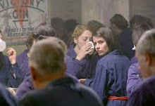
New storm brings flood watches, wind advisories, and high surf warnings
(KCAL News) Feb. 19, 2024: Weather Forecast Olga Ospina continues coverage of the newest storm sweeping into Southern California, which brings flooding threats along with powerful winds and high surf warnings. The Sepulveda Basin (San Fernando Valley) has been closed due to flooding.
Storm moves into Southern California, bringing heavy rain to some areas

Live updates: Flood warnings for California
(KTLA) LOS ANGELES, California - Monday, Feb. 19, 2024: KTLA 5 Meteorologist Henry DiCarlo has an update on the latest atmospheric river to soak Los Angeles and other parts of SoCal.

It was always an island on early European maps.
Surrounding counties are already seeing big problems, mansions teetering on cliffs in Orange County, avalanches in San Bernardino, landslides in Ventura, roads washing out, mudslides, sink holes, lake growing in Death Valley, snow piling up in local mountains, and the loop of water from San Felipe, Mexico, up to the Colorado River soaking up so much H20 that a return to state islandhood is not impossible.

"Islandhood"? Oh yeah, California used to be a mythological island and probably a literal one, too.

(KCRA 3) Northern California also being pummeled by rainstorms.

California Island?
Wisdom Quarterly Wiki edit

I am the Conqueror Hernan Cortes
In 1533, Fortún Ximénez, a mutineer on an exploratory expedition sent by Hernán Cortés, discovered the southern portion of Baja California, around present-day La Paz.

He was taken down by Natives, but his men returned to New Spain and reported their find.

In 1535, Cortés arrived in the bay there and named the area Santa Cruz; he attempted to start a colony (imperial outstation) but abandoned his efforts after several years due to logistical problems.

Cortés' limited information on southern Baja California apparently led to the naming of the region after the legendary "California" and to an initial but short-lived assumption that it was a large island [8, 9].

In 1539, Cortés sent the navigator Francisco de Ulloa northward along the Gulf and Pacific coasts of Baja California. Ulloa reached the mouth of the Colorado River at the head of the Gulf, which seemed to show that the region was technically a peninsula rather than an island [10] -- unless sea levels were higher.

Ulloa was quoted as having described the land he saw on his expedition as, "High and bare, of wretched aspect without any verdure" [5].

An expedition under Hernando de Alarcón ascended the lower Colorado River and confirmed Ulloa's finding.

European maps published subsequently during the 16th century, including those by Gerardus Mercator and Abraham Ortelius, showed Baja ("Lower") California as a peninsula. More

KTLA 5 News has been keeping Southern Californians informed since 1947.

Monday, December 18, 2017

Native Americans: People of the Desert (video)

Discovery via Angie Robey-Stream; Xochitl, Ashley Wells (eds.), Wisdom Quarterly; Wiki edit


The Anasazi: Ancestral Puebloans
The famous cliff dwelling before disappearance (Cliff Palace, Mesa Verde National Park)
.
The Anasazi or Ancestral Puebloans were an ancient Native American culture that spanned the present-day Four Corners region of the United States:
  1. Southeastern Utah
  2. Northeastern Arizona
  3. Northwestern New Mexico
  4. Southwestern Colorado.
The Ancestral Puebloans are believed to have developed, at least in part, from the Oshara Tradition, who developed from the Picosa culture.
 
They lived in a range of structures that included small family pit houses, larger structures to house clans, grand pueblos, and cliff-sited dwellings for defense.

The Ancestral Puebloans possessed a complex network that stretched across the Colorado Plateau linking hundreds of communities and population centers.

White House Ruins, Canyon de Chelly
They held a distinct knowledge of celestial sciences that found form in their architecture. The kiva, a congregational space that was used chiefly for ceremonial purposes, was an integral part of this ancient people's community structure.
 
In contemporary times, the people and their archaeological culture were referred to as Anasazi for historical purposes. The Navajo, who were not their descendants, called them by this term.

Reflecting historic traditions, the term was used to mean "ancient enemies." Contemporary Puebloans do not want this term to be used.
 
Horseshoe Tower, Hovenweep
Archaeologists continue to debate when this distinct culture emerged. The current agreement, based on terminology defined by the Pecos Classification, suggests their emergence around the 12th century BCE, during the archaeologically designated Early Basketmaker II Era.

Beginning with the earliest explorations and excavations, researchers identified Ancestral Puebloans as the forerunners of contemporary Pueblo peoples. Three UNESCO World Heritage Sites located in the United States are credited to the Pueblos:
  1. Mesa Verde National Park 
  2. Chaco Culture National Historical Park
  3. Taos Pueblo
Pueblo, which means "village" in Spanish, was a term originating with the Spanish explorers who used it to refer to the people's particular style of dwelling.

The Navajo people, who now reside in parts of former Pueblo territory, referred to the ancient people as Anaasází, an exonym meaning "ancestors of our enemies," referring to their competition with the Pueblo peoples. The Navajo now use the term in the sense of referring to "ancient people" or "ancient ones."
 
Hopi people used the term Hisatsinom, meaning "ancient people," to describe the Ancestral Puebloans. More

Thursday, March 27, 2014

Buddhist cave temples found in Grand Canyon

Dhr. Seven and Ashley Wells (eds.), Wisdom Quarterly, Jack Andrews, "Was the carved 'installation' in the Grand Canyon an ancient Buddhist temple?" (Lost Civilizations / in Spanish)
The Gazette headlines of April 5, 1909 document the reality of these unbelievably astounding finds, some of the greatest US archeological discoveries ever. Why were they covered up?
 
Better than feathers (Jamyang190/blog)
In the vast Grand Canyon of Arizona, USA, there is an Egyptian-style tomb full of Buddhist art showing that Asians migrated to America and brought the Dharma and advanced technology to Native Americans in the distant past. It is similar to the Valley of Kings in Luxor, Egypt. While this will be too fantastic for most readers to believe, the trail of evidence begins with an article published on the front page of the Arizona Gazette on April 5, 1909. It claims that just such a rock-cut cavern temple full of Buddhist, Vedic, and Egyptian art and architecture, hieroglyphs, and mummies -- an almost incomprehensible wealth of archaeological treasures -- was discovered.

Marble Canyon, Grand Canyon Nat'l Park
"According to the story related to the Gazette by Mr. Kinkaid, the archaeologists of the Smithsonian Institute, which is financing the expeditions, have made discoveries which almost conclusively prove that the race which inhabited this mysterious cavern, hewn in solid rock by human hands, was of oriental origin..." - Arizona Gazette, April 5, 1909

"First, I would impress that the cavern is nearly inaccessible. The entrance is 1,486 feet down the sheer canyon wall"G.E. Kincaid, 1909 

Was the carved "installation" in the Grand Canyon an ancient Buddhist temple?
 
Mt. Hengshan, China, near Datong, Shanxi Province
Photos show how ancient Chinese Buddhist monks went out of there way to carve their temples in cliff faces in remote and inaccessible cliff-lined river canyons.

Other clues to the speculation that the installation may have been used for such a purpose are broken swords and cups and other items, often used ceremonially in ancient Chinese Buddhist temples, were found in the cave in 1909. The cave lies in Marble Canyon (above photo), which is a steep limestone wall-lined canyon. It it is similar to the Hanging or Mid-Air temples on Mount Hengshan, China, southeast of Datong, Shanxi Province.

They cling precariously to the cliff face and illustrate determined isolation of the early Buddhist communities in China. 

Founded in pre-Tang Northern Wei Dynasty, the temples continued to function during the Tang period and were subsequently restored in the Ming and Qing dynasties (Tang China: Vision and Splendour of a Golden Age by Edmund Capon with photography by Werner Forman, Macdonald Orbis, 1989). 
 
Bezeklik Thousand Buddha Caves (left) high on the cliffs of the west Mutou Valley under the Flaming Mountains, 27 miles (45 km) east of Turpan near Shanshan in Western China's Uygur Autonomous Region, northeast of Taklamakan Desert, Xinjiang. The caves feature  ancient Buddhist monasteries carved into cliffs dating from ~400 AD to 1,300  AD. More
  
"Approximately 70 km. (45 miles) east of Turfan lie the Buddhist cave-cliff temples of Bezeklik, most of which were originally built in the open and joined by wooden porches.
 
Grand Canyon Egyptian finds (lightworkers.org)
"Others were carved into the living rock in the manner of cave temples. The height of activity at Bezeklik, on the evidence of surviving wall paintings, was the Tang Dynasty, when Silk Road trade brought travelers, merchants, and missionaries to the temples in search of sanctuary and spiritual comfort.

Today they are still difficult to reach, for the monks endeavored, even here in the desert wastelands of Chinese Central Asia, to build their temples as far away as possible from the real and profane world" (Ibid.)
 
Mai-Chi caves, Chinling range, China (Magnificant China, Hong Kong, Hua Hsia Publ., 1972)
 
Indian Legend
Burmese cave temple (Nadia Isakova/flickr)
It is notable that among the Hopis, the tradition is told that their ancestors once lived in an underworld in the Grand Canyon. This went on until dissension arose between the good and the bad, the people of one heart, the people of two hearts.
 
(Manchoto), who was their chief, counseled them to leave the underworld, but there was no way out. The chief then caused a tree to grow up and pierce the roof of the underworld, and then the people of one heart climbed out.

They tarried by Palsiaval (Red River), which is the Colorado river, and grew grain and corn. They sent out a message to the Temple of the Sun, asking for blessings of peace, goodwill, and rain for the people of one heart.

That messenger never returned, but today at the Hopi village at sundown can be seen the old men of the tribe out on the housetops gazing towards the Sun, looking for the messenger. When he returns, their land and ancient dwelling place will be restored to them. That is the tradition. More
The Kogi, Sierra Nevada (RinzaisMarket.com, Sedona, AZ, world-healing.com)

Monday, August 31, 2009

Thousand Buddha Cliffs discovered in China


Three cliffs each containing about a thousand Buddha carvings appeared beside a reservoir in San Su County, in Sichuan province. (Image: newssc.net).

In early August, three cliffs each containing hundreds of Buddha carvings appeared beside a reservoir in San Su County, in Sichuan province, China. The Buddhas, which have different expressions, are well preserved.

Most villagers said they never knew these "Buddha cliffs" existed. However, an old man said he had seen them about 49 years ago. In fact, this place used to be a temple. In 1963, construction of the Chen Gou Reservoir was completed, and the three Buddha cliffs were submerged. In 1983, it was declared a heritage conservation unit at the county level.

According to one expert, the decision to submerge the Buddha cliffs in water was opposed by cultural sectors. However, compared to exposing the Buddhas to the elements, submerging is a much a much better preservation method even though they would also be eroded by water to some extent. Source